Analysis of bush encroachment with NOAA-AVHRR-data in Etosha National Park (Namibia)
Project Description
Bush encroachment is a process of land degradation in savanna ecosystems, which therefore affects pasture farming in Southern Africa. A time series of NOAA AVHRR NDVI-Data at high temporal resolution is used to develop a methodology for real-time monitoring of bush encroachment at large scales. The analysis is based on the assumption, that in semiarid environments each type of vegetation (e.g. grass savanna, shrub savanna, tree savanna) reacts on rainfall in a specific way by having a characteristic phenology, which can be used for a separation of homogenous areas.
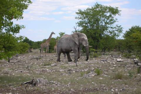
The Etosha National Park in Northern Namibia was chosen as study site and a time series of 10-day Maximum Value Composites (MVC) from 1993 to 2001 was obtained from the Etosha Ecological Institute (EEI), where a receiving station for NOAA AVHRR HRPT-Data was installed in 1993. Due to the fact that absolute NDVI-values as recorded by the AVHRR are noise-affected by variations in viewing geometry, soil background and atmospheric disturbance, a harmonic analysis was performed on the data to model the NDVI-curves on a pixel basis.
To account for continuity missing data was interpolated and outliers were removed from the NDVI-profiles. As a consequence of rainfall variability the NDVI of a distinct pixel is not really a periodic function, which would be necessary for a harmonic analysis. Therefore, each year is processed separately.
The first seven harmonic terms were computed, having a characteristic amplitude and phase values. Including the mean, each NDVI-curve can be described by their parameters, which can also be easier related to earth surface processes. The mean represents the overall productivity of vegetation, whereas the amplitude indicates the degree of change in a given term. The phase angle describes the time of maximum greenness. Each term accounts for a part of the variance contained in the original data. The degree of explanation was therefore used to select dominant terms and the standardized parameters of these terms were used in an unsupervised ISODATA classification to separate regions having a similar NDVI-trend. As, theoretically, a simple cause can produce a complex curve, which can only be reproduced by a higher number of harmonics, additional classifications with the parameters of all seven terms were computed. Furthermore, the representation of the NDVI-curves by the parameters of the harmonic terms was checked by producing classifications of the modelled data.
A vegetation map generated from a supervised Landsat-TM classification in 1994 was used as reference data to evaluate the results of the 1993/94 and 1994/95 rainy seasons. A further application of the methodology to following years would only be of practical use, if reliable results can be achieved unsupervised. The interpretation of the explained variance and the curve parameters revealed differences in both seasons. In general, the lower terms already account for the main part of the variance and proof the good quality of the model, but while in 1993 the first two terms are capable to describe the NDVI-trend, in 1994 three terms are necessary. In the first case, the high importance of the first terms corresponds with the unimodal character of the rainy season, the different rainfall situation in 1994 with dry periods results in a complex NDVI-trend and causes the 2nd and 3rd term being more relevant.
In the images, the spatial patterns of the explained variance and especially of the curve parameters differ significantly in both seasons, but again agree with the trends observed from the available rainfall stations. According to these results the classifications computed with the curve parameters and the modelled NDVI-values show strong differences and are not comparable for both years. The same goes for the NDVI-trends of the individual classes, which are completely different in progress for a chosen sample area. None of the different classifications fits the Etosha vegetation map very well. The overall accuracies in the computed error matrices do not exceed 40% and are even lower in most cases. Even if a slightly better accuracy can be observed by analyzing individual classes, little agreement in consecutive seasons confirms the statements regarding the different rainfall situation. The overall accuracy with the vegetation map is even lower than 40%, if the standardized parameters of the higher terms are included in the classification process. From the obtained results it can be concluded, that the NDVI-trends of a single year do not represent a characteristic phytophenology, but the reaction of plant cover on the actual rainfall situation with its high spatio-temporal variation. A detection of bushland for a real-time monitoring of bush encroachment is therefore not possible with the presented methodology.
Project Members
- Prof. Dr. Cyrus Samimi
- Research associate: Dr. H. Wagenseil
Project Partner
- J. Le Roux (Ministry of Agriculture, Water & Forestry, Windhoek, Namibia)
Financial Support
- funded by DFG